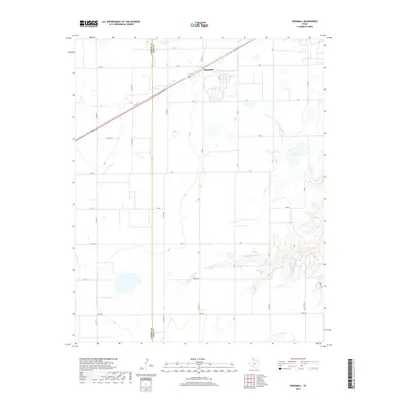
2019 Map of Kingsmill
USGS Topo · Published 2019About this map
Kingsmill sits at the intersection of industry and the high plains, situated along the diagonal corridor of U.S. Route 60. The landscape is defined by the sharp transition between the flat upland cattle and agricultural lands and the deeply eroded breaks of the N Fork Red River. This river system, including landmarks like Bell Lake, carves through the eastern portion of the quadrangle, creating a complex drainage network that contrasts with the rigid grid of county section roads. The boundary of Carson Co Gray Co bisects the western half of the map, marking the legal divide in a region dominated by ranching and oil development. Local history is etched into the landscape through family-named routes such as Boydston Rd, Halduk Rd, and Oneal Rd, which provide access to the remote draws and creek beds of the Texas Panhandle.
Find a feature on this map
28 named features on this map. Tap any name to fly to it.
Don’t see what you’re looking for? This feature index may not catch every label — zoom into the map to look around manually.
Map Details
Editions of this 2019 Kingsmill Map
This is the sole edition of this map. No revisions or reprints were ever made.
Other maps of this area

1954 · Amarillo
USGS Topo · 1:250,000

1958 · Amarillo
USGS Topo · 1:250,000

1963 · Pampa
USGS Topo · 1:24,000

1963 · Skellytown
USGS Topo · 1:24,000

1965 · White Deer
USGS Topo · 1:24,000

1965 · Lake Mc Connell
USGS Topo · 1:24,000

1966 · Grandview School
USGS Topo · 1:24,000

1966 · White Deer SW
USGS Topo · 1:24,000

1966 · Kingsmill
USGS Topo · 1:24,000

1966 · Bowers City
USGS Topo · 1:24,000