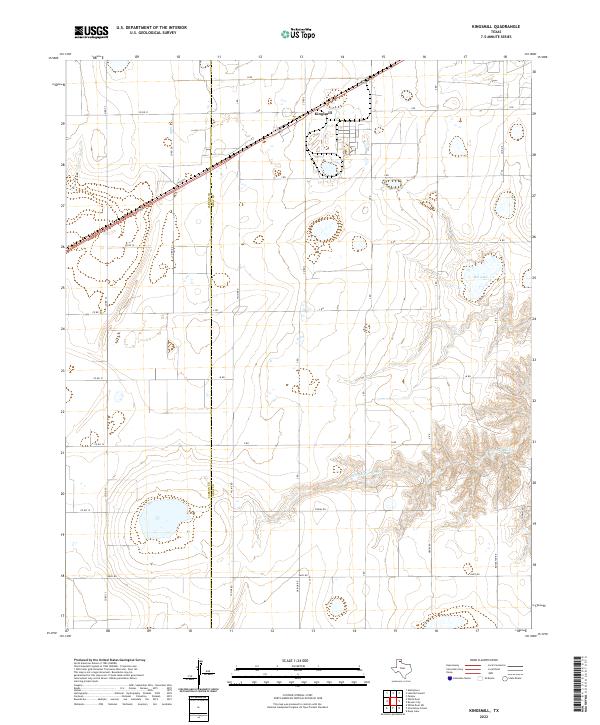
2022 Map of Kingsmill
USGS Topo · Published 2022About this map
Kingsmill sits at the intersection of rail and road in the northern Panhandle, situated right on the border of Carson and Gray Counties. This 2022 survey illustrates a landscape defined by large-scale agricultural blocks and a network of grid-patterned roads, including family-named routes like Haiduk Rd and O'Neal Rd. The topography is largely level across the northern sections, but the terrain begins to break and erode significantly as it approaches the southern reaches of the map.
Find a feature on this map
33 named features on this map. Tap any name to fly to it.
Don’t see what you’re looking for? This feature index may not catch every label — zoom into the map to look around manually.
Map Details
Editions of this 2022 Kingsmill Map
This is the sole edition of this map. No revisions or reprints were ever made.
Other maps of this area

1954 · Amarillo
USGS Topo · 1:250,000

1958 · Amarillo
USGS Topo · 1:250,000

1963 · Pampa
USGS Topo · 1:24,000

1963 · Skellytown
USGS Topo · 1:24,000

1965 · White Deer
USGS Topo · 1:24,000

1965 · Lake Mc Connell
USGS Topo · 1:24,000

1966 · Grandview School
USGS Topo · 1:24,000

1966 · White Deer SW
USGS Topo · 1:24,000

1966 · Kingsmill
USGS Topo · 1:24,000

1966 · Bowers City
USGS Topo · 1:24,000