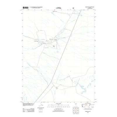
2012 Map of Kingston
USGS Topo · Published 2012About this map
Kingston sits at the base of the eastern Toiyabe Range, where high-desert canyons meet the Big Smoky Valley. This 2012 survey illustrates a landscape defined by water and ranching, with Kingston Creek and Bowman Creek providing the lifeblood for the Triple T Ranch and Bowman Ranch. The settlement layout includes several residential streets like Toquima Way and Jefferson Dr, reflecting the area's development as a local hub for those working the land or the nearby industrial sites.
Find a feature on this map
34 named features on this map. Tap any name to fly to it.
Don’t see what you’re looking for? This feature index may not catch every label — zoom into the map to look around manually.
Map Details
Editions of this 2012 Kingston Map
This is the sole edition of this map. No revisions or reprints were ever made.
Other maps of this area

1926 · Roberts Mountains
USGS Topo · 1:250,000

1929 · Roberts Mountains
USGS Topo · 1:250,000

1955 · Millett
USGS Topo · 1:250,000

1956 · Millett Ranch
USGS Topo · 1:62,500

1956 · Austin
USGS Topo · 1:62,500

1959 · Millett
USGS Topo · 1:250,000

1960 · Spencer Hot Springs
USGS Topo · 1:62,500

1960 · Wildcat Peak
USGS Topo · 1:62,500

1978 · Summit Mountain
USGS Topo · 1:100,000

1985 · Smith Creek Valley
USGS Topo · 1:100,000