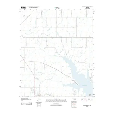
2010 Map of Kingston North
USGS Topo · Published 2010About this map
Lake Texoma dominates the southeastern portion of this landscape, its fingers reaching up into the surrounding Marshall County terrain where Glasses Creek and Little Glasses Creek drain toward the reservoir. The town of Kingston sits near the southwestern corner, serving as a hub for the local road network that includes family-named routes like Gary Rd and Watkins Rd. Industrial activity is evident throughout the area, marked by the extensive Madill Oil Field, North Madill Oil Field, and the Aylesworth Oil Field situated near the lake's edge. This 2010 survey also highlights local landmarks such as Cliff Cemetery and the Roosevelt Memorial Bridge, reflecting a community defined by its connection to both the water and the regional energy economy.
Find a feature on this map
32 named features on this map. Tap any name to fly to it.
Don’t see what you’re looking for? This feature index may not catch every label — zoom into the map to look around manually.
Map Details
Editions of this 2010 Kingston North Map
This is the sole edition of this map. No revisions or reprints were ever made.
Other maps of this area

1901 · Tishomingo
USGS Topo · 1:125,000

1901 · Denison
USGS Topo · 1:125,000

1954 · Sherman
USGS Topo · 1:250,000

1957 · Ardmore
USGS Topo · 1:250,000

1958 · Gordonville
USGS Topo · 1:62,500

1958 · Denison Dam
USGS Topo · 1:62,500

1958 · Sherman
USGS Topo · 1:250,000

1963 · Ardmore
USGS Topo · 1:250,000

1963 · Madill
USGS Topo · 1:24,000

1963 · Ravia
USGS Topo · 1:24,000