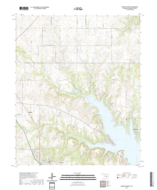
2022 Map of Kingston North
USGS Topo · Published 2022About this map
Madill and Kingston serve as the primary anchors of this Marshall County landscape, where the northern reaches of Lake Texoma meet the Oklahoma plains. The terrain is defined by the winding course of the Washita River and the expansive waters of Little Glasses Bay, which dominates the southeastern portion of the map. This 2022 survey captures the modern road network, including family-named routes like Moore Rd and Bowlin Rd, which weave between agricultural tracts and established settlements. Genealogists will find several burial sites preserved across the landscape, such as the Moore Burney Cem near Aylesworth and the Cliff Cem perched above a bend in Little Glasses Cr. The transition from the rural community of Linn in the northeast to the more developed corridors near the lake reflects the region's shift toward water-adjacent recreation and land management.
Find a feature on this map
63 named features on this map. Tap any name to fly to it.
Don’t see what you’re looking for? This feature index may not catch every label — zoom into the map to look around manually.
Map Details
Editions of this 2022 Kingston North Map
This is the sole edition of this map. No revisions or reprints were ever made.
Other maps of this area

1901 · Tishomingo
USGS Topo · 1:125,000

1901 · Denison
USGS Topo · 1:125,000

1954 · Sherman
USGS Topo · 1:250,000

1957 · Ardmore
USGS Topo · 1:250,000

1958 · Gordonville
USGS Topo · 1:62,500

1958 · Denison Dam
USGS Topo · 1:62,500

1958 · Sherman
USGS Topo · 1:250,000

1963 · Ardmore
USGS Topo · 1:250,000

1963 · Madill
USGS Topo · 1:24,000

1963 · Ravia
USGS Topo · 1:24,000