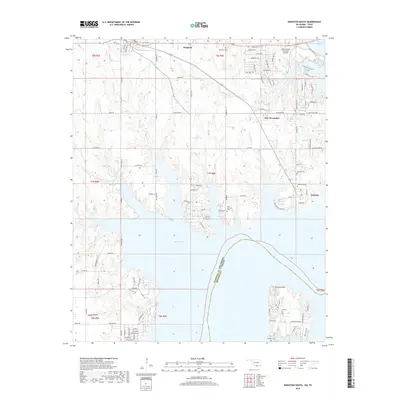
2018 Map of Kingston South
USGS Topo · Published 2018About this map
Lake Texoma dominates the southern half of this landscape, its expansive waters meeting the shorelines of Marshall County, Oklahoma, and Grayson County, Texas. The northern reaches show a transition from the town of Kingston toward the lake's northern arms, where several smaller communities like New Woodville and McBride are situated. The terrain is marked by significant hydrological features, including the Washita River and numerous creeks such as Rooster Cr, Soldier Cr, and Alberta Cr that drain into the reservoir.
Find a feature on this map
121 named features on this map. Tap any name to fly to it.
Don’t see what you’re looking for? This feature index may not catch every label — zoom into the map to look around manually.
Map Details
Editions of this 2018 Kingston South Map
This is the sole edition of this map. No revisions or reprints were ever made.
Other maps of this area

1901 · Tishomingo
USGS Topo · 1:125,000

1901 · Denison
USGS Topo · 1:125,000

1954 · Sherman
USGS Topo · 1:250,000

1957 · Denison Dam
USGS Topo · 1:24,000

1957 · Ardmore
USGS Topo · 1:250,000

1958 · Gordonville
USGS Topo · 1:62,500

1958 · Denison Dam
USGS Topo · 1:62,500

1958 · Sherman
USGS Topo · 1:250,000

1963 · Ardmore
USGS Topo · 1:250,000

1963 · Madill
USGS Topo · 1:24,000