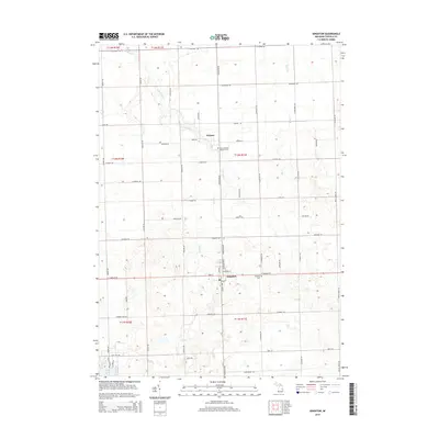
2014 Map of Kingston
USGS Topo · Published 2014About this map
Kingston and the surrounding farmland of Tuscola County are defined by a grid of rural roads and small drainage tributaries in this 2014 survey. The settlement of Wilmot sits to the north, connected to the larger village by S Kingston Rd. The landscape is heavily influenced by its hydrology, featuring the S Br White Cr and Alder Cr which cut through the agricultural sections. For those researching local history or families, the map identifies significant sites such as the Kingston Cem on the eastern edge of town and Saint Michael's Catholic Cem located near the intersection of S Kingston Rd and Wilcox Rd. The southern portion of the quadrangle reaches toward Shay Lake, illustrating the transition from the village center into more wooded, water-rich terrain.
Find a feature on this map
60 named features on this map. Tap any name to fly to it.
Don’t see what you’re looking for? This feature index may not catch every label — zoom into the map to look around manually.
Map Details
Editions of this 2014 Kingston Map
This is the sole edition of this map. No revisions or reprints were ever made.
Other maps of this area

1954 · Flint
USGS Topo · 1:250,000

1958 · Flint
USGS Topo · 1:250,000

1963 · Clifford
USGS Topo · 1:24,000

1963 · East Dayton
USGS Topo · 1:24,000

1963 · Mayville
USGS Topo · 1:24,000

1963 · Marlette
USGS Topo · 1:24,000

1963 · Kingston
USGS Topo · 1:24,000

1963 · Cass City
USGS Topo · 1:24,000

1963 · Ellington
USGS Topo · 1:24,000

1963 · Shabbona
USGS Topo · 1:24,000