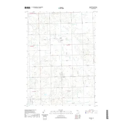
2019 Map of Kingston
USGS Topo · Published 2019About this map
Wilmot and the surrounding farmland of Tuscola County define this landscape, where the local economy and geography are intricately tied to a complex network of man-made and natural waterways. The drainage patterns of the area are heavily modified, featuring numerous named systems such as Evans Drain, Tallman Drain, and Snover Drain that channel water toward larger bodies like Mud Cr. This sophisticated drainage network is essential for the agricultural productivity of the region, allowing for the cultivation of the fields that stretch between a grid of rural roads like Mushroom Rd and Sanilac Rd. Genealogists will find interest in the documented burial grounds of the community, including Kingston Cem and the Saint Michael's Catholic Cem near the Wilmot settlement. The map captures a high level of detail for rural properties and land divisions within the township and range system.
Find a feature on this map
74 named features on this map. Tap any name to fly to it.
Don’t see what you’re looking for? This feature index may not catch every label — zoom into the map to look around manually.
Map Details
Editions of this 2019 Kingston Map
This is the sole edition of this map. No revisions or reprints were ever made.
Other maps of this area

1954 · Flint
USGS Topo · 1:250,000

1958 · Flint
USGS Topo · 1:250,000

1963 · Clifford
USGS Topo · 1:24,000

1963 · East Dayton
USGS Topo · 1:24,000

1963 · Mayville
USGS Topo · 1:24,000

1963 · Marlette
USGS Topo · 1:24,000

1963 · Kingston
USGS Topo · 1:24,000

1963 · Cass City
USGS Topo · 1:24,000

1963 · Ellington
USGS Topo · 1:24,000

1963 · Shabbona
USGS Topo · 1:24,000