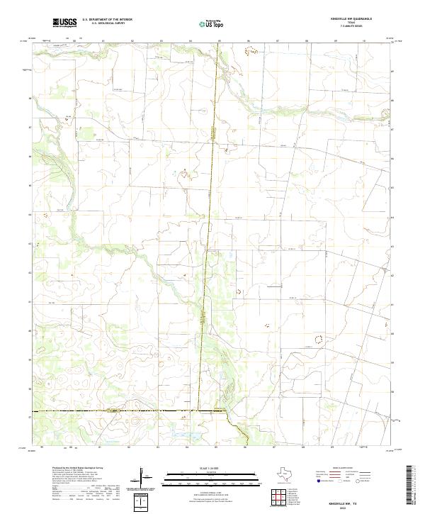
2022 Map of Kingsville NW
USGS Topo · Published 2022About this map
San Fernando Cr winds through this South Texas landscape where the borders of Jim Wells, Nueces, and Kleberg counties converge. The terrain is characterized by a low-lying drainage network where Pintas Cr and Lattas Cr feed into the broader coastal plain, eventually reaching the southern boundary at Ogados Lake.
Find a feature on this map
30 named features on this map. Tap any name to fly to it.
Don’t see what you’re looking for? This feature index may not catch every label — zoom into the map to look around manually.
Map Details
Editions of this 2022 Kingsville NW Map
This is the sole edition of this map. No revisions or reprints were ever made.
Other maps of this area

1917 · Ben Bolt
USGS Topo · 1:62,500

1920 · San Diego
USGS Topo · 1:62,500

1950 · Corpus Christi
USGS Topo · 1:250,000

1954 · Orange Grove
USGS Topo · 1:62,500

1954 · Kingsville
USGS Topo · 1:62,500

1956 · Corpus Christi
USGS Topo · 1:250,000

1956 · Laredo
USGS Topo · 1:250,000

1960 · Corpus Christi
USGS Topo · 1:250,000

1963 · Ben Bolt SE
USGS Topo · 1:24,000
1963 · Alice North
USGS Topo · 1:24,000