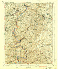
1925 Map of Kingwood
USGS Topo · Published 1942About this map
The Cheat River carves a winding path through this corner of Preston County, defining a landscape where the Baltimore and Ohio railroad and historic turnpikes dictate the movement of goods and people. The county seat of Kingwood serves as a northern anchor, while the river's dramatic bends near Rowlesburg and Manheim reveal the intensive engineering required to navigate the mountain terrain. Settlements like Terra Alta and Tunnelton highlight the importance of the rail line, while the southern reaches of the map transition into the protected lands of the Monongahela National Forest.
Find a feature on this map
110 named features on this map. Tap any name to fly to it.
Don’t see what you’re looking for? This feature index may not catch every label — zoom into the map to look around manually.
Map Details
Editions of this 1925 Kingwood Map
3 editions found

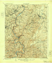
Other maps of this area

1886 · St. George
USGS Topo · 1:125,000

1891 · St. George
USGS Topo · 1:125,000

1895 · Piedmont
USGS Topo · 1:125,000

1899 · Oakland
USGS Topo · 1:62,500

1900 · Accident
USGS Topo · 1:62,500

1900 · Oakland
USGS Topo · 1:62,500

1902 · Morgantown
USGS Topo · 1:62,500

1904 · Bruceton
USGS Topo · 1:62,500

1907 · Thornton
USGS Topo · 1:62,500

1907 · Kingwood
USGS Topo · 1:62,500