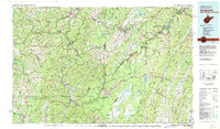
1981 Map of Kingwood
USGS Topo · Published 1982About this map
The Cheat River and North Branch Potomac River carve through the high ridges of the Central Appalachians on this 1981 survey of the West Virginia and Maryland border. This region, dominated by the Monongahela National Forest, shows a landscape defined by industrial extraction and high-altitude wilderness. Extensive Gas Field operations appear near the Maryland line, while the rail infrastructure of the Baltimore & Ohio RR and Western Maryland RR follows the narrow river valleys to serve mountain settlements like Terra Alta and Rowlesburg. Significant recreational and conservation areas are established across the terrain, including the Dolly Sods Wilderness Area and Canaan Valley State Park. Large water bodies like Deep Creek Lake and Mount Storm Lake serve as major landmarks amidst the primary ridges of Backbone Mountain and the Allegheny Front.
Find a feature on this map
213 named features on this map. Tap any name to fly to it.
Don’t see what you’re looking for? This feature index may not catch every label — zoom into the map to look around manually.
Map Details
Editions of this 1981 Kingwood Map
This is the sole edition of this map. No revisions or reprints were ever made.
Other maps of this area

1886 · St. George
USGS Topo · 1:125,000

1889 · Beverly
USGS Topo · 1:125,000

1891 · St. George
USGS Topo · 1:125,000

1891 · Romney
USGS Topo · 1:125,000

1892 · Beverly
USGS Topo · 1:125,000

1892 · Franklin
USGS Topo · 1:125,000

1892 · Woodstock
USGS Topo · 1:125,000

1893 · Buckhannon
USGS Topo · 1:125,000

1895 · Piedmont
USGS Topo · 1:125,000

1896 · Buckhannon
USGS Topo · 1:125,000