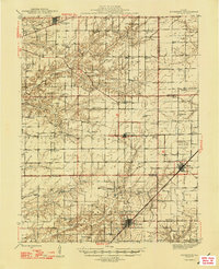
1947 Map of Kinmundy
USGS Topo · Published 1947About this map
Kinmundy and Farina anchor this 1940s landscape at the crossroads of three major railroads. The Illinois Central and Chicago And Eastern Illinois lines cut through the south, while the Pennsylvania railroad services Brownstown in the north. This survey reveals a dense network of rural one-room schoolhouses and small-town congregations that defined the social structure of Marion, Fayette, and Effingham counties before mid-century consolidation.
Find a feature on this map
68 named features on this map. Tap any name to fly to it.
Don’t see what you’re looking for? This feature index may not catch every label — zoom into the map to look around manually.
Map Details
Editions of this 1947 Kinmundy Map
2 editions found

Other maps of this area

1914 · Centralia
USGS Topo · 1:62,500

1934 · Salem
USGS Topo · 1:62,500

1935 · Centralia
USGS Topo · 1:62,500

1938 · Salem
USGS Topo · 1:62,500

1941 · St. Elmo
USGS Topo · 1:62,500

1944 · Ramsey
USGS Topo · 1:62,500

1945 · St. Elmo
USGS Topo · 1:62,500

1945 · Kinmundy
USGS Topo · 1:62,500

1945 · Vandalia
USGS Topo · 1:62,500

1946 · Ramsey
USGS Topo · 1:62,500