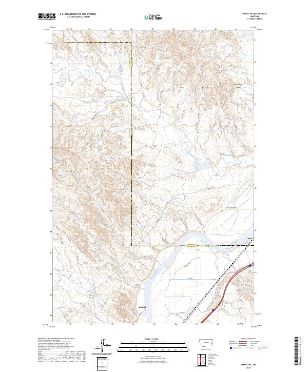
2024 Map of Kinsey NE
USGS Topo · Published 2024About this map
The Yellowstone River cuts through this Eastern Montana landscape, defining the border between Custer and Prairie counties. The terrain is characterized by a series of significant drainage features and high-relief formations, most notably the Devils Backbone south of the river and a network of coulees including Gate Coulee and Yellowstone Coulee to the north. Settlement and transportation patterns are tied closely to the river valley, where the small localities of Bonfield and Benz are situated along historic corridors.
Find a feature on this map
28 named features on this map. Tap any name to fly to it.
Don’t see what you’re looking for? This feature index may not catch every label — zoom into the map to look around manually.
Map Details
Editions of this 2024 Kinsey NE Map
This is the sole edition of this map. No revisions or reprints were ever made.
Other maps of this area

1953 · Miles City
USGS Topo · 1:250,000

1957 · Miles City
USGS Topo · 1:250,000

1958 · Miles City
USGS Topo · 1:250,000

1969 · Corral Butte
USGS Topo · 1:24,000

1969 · Zero
USGS Topo · 1:24,000

1969 · Kinsey NE
USGS Topo · 1:24,000

1969 · Kinsey
USGS Topo · 1:24,000
1969 · Shirley
USGS Topo · 1:24,000
1969 · Kinsey NW
USGS Topo · 1:24,000

1972 · Calypso
USGS Topo · 1:24,000