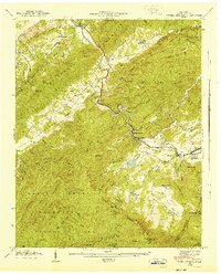
1941 Map of Kinzel Springs
USGS Topo · Published 1941About this map
The Little River winds through the heart of this Blount County survey, charting the narrow valley corridor between Chilhowee Mountain and the rising slopes of the Great Smoky Mountains National Park. At this time in the early 1940s, the landscape is defined by the rural clusters of Townsend, Kinzel Springs, and Walland. The map reveals a dense network of local institutions essential to these mountain communities, including Miller Cove Ch, Tuckaleechee Chapel, and the Caylor Sch.
Find a feature on this map
104 named features on this map. Tap any name to fly to it.
Don’t see what you’re looking for? This feature index may not catch every label — zoom into the map to look around manually.
Map Details
Editions of this 1941 Kinzel Springs Map
This is the sole edition of this map. No revisions or reprints were ever made.
Other maps of this area

1886 · Knoxville
USGS Topo · 1:125,000

1892 · Knoxville
USGS Topo · 1:125,000

1894 · Knoxville
USGS Topo · 1:125,000

1895 · Knoxville
USGS Topo · 1:125,000

1901 · Knoxville
USGS Topo · 1:125,000

1935 · Knoxville
USGS Topo · 1:48,000

1935 · Walden Creek
USGS Topo · 1:24,000

1935 · Maryville
USGS Topo · 1:24,000

1935 · Wildwood
USGS Topo · 1:24,000

1935 · Calderwood
USGS Topo · 1:24,000