
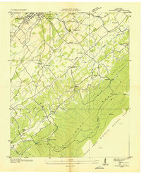
1935 Map of Wildwood
USGS Topo · Published 1935About this map
Chilhowee Mountain and Black Oak Ridge define the topography of this Tennessee Valley Authority study, which captures the rural landscape of Blount County in the mid-1930s. The settlement pattern is anchored by small communities like Wildwood and Providence, with a notable density of local institutions that suggest a deeply rooted agrarian society. Along the Little River and its various tributaries such as Ellejoy Creek and Nale Creek, the map records several country schools and churches, including Klondike Sch, Eusebia Ch, and Union Temple. These landmarks, along with family-named features like Yankee Hill and Pickens Gap, provide a detailed view of the county before significant modern development. The presence of State Highway No 71 and the Southern railroad line reflects the transportation infrastructure connecting these mountain valleys to the broader region.
Find a feature on this map
39 named features on this map. Tap any name to fly to it.
Don’t see what you’re looking for? This feature index may not catch every label — zoom into the map to look around manually.
Map Details
Editions of this 1935 Wildwood Map
This is the sole edition of this map. No revisions or reprints were ever made.
Other maps of this area

1886 · Knoxville
USGS Topo · 1:125,000

1892 · Knoxville
USGS Topo · 1:125,000

1894 · Knoxville
USGS Topo · 1:125,000

1895 · Knoxville
USGS Topo · 1:125,000

1901 · Knoxville
USGS Topo · 1:125,000

1935 · Knoxville
USGS Topo · 1:48,000

1935 · Walden Creek
USGS Topo · 1:24,000

1935 · Maryville
USGS Topo · 1:24,000
1935 · Blockhouse
USGS Topo · 1:24,000

1935 · Sevierville
USGS Topo · 1:48,000