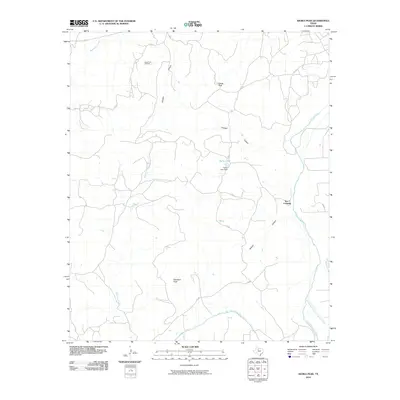
2010 Map of Kiowa Peak
USGS Topo · Published 2010About this map
Kiowa Peak and Davidson Peak dominate the topography of this Stonewall County landscape, where the early 21st-century cattle and energy industries intersect. The complex hydrology of the region is centered on the confluence of the Salt Fork Brazos River and the Double Mountain Fork Brazos River, creating a jagged network of drainages including Panther Canyon, Smelter Canyon, and Beaver Canyon. Cultural landmarks such as Two F Crossing on the Brazos River reflect the ranching heritage of the area, while the Kiowa Park Oil Field in the north indicates the significant role of mineral extraction. Modern infrastructure like Keller Lake Dam and the various county roads and private paths provide access through this drainage-rich terrain of West Texas.
Find a feature on this map
20 named features on this map. Tap any name to fly to it.
Don’t see what you’re looking for? This feature index may not catch every label — zoom into the map to look around manually.
Map Details
Editions of this 2010 Kiowa Peak Map
This is the sole edition of this map. No revisions or reprints were ever made.
Other maps of this area

1925 · Aspermont 4-a
USGS Topo · 1:48,000

1925 · Haskell 3-b
USGS Topo · 1:48,000

1931 · Aspermont
USGS Topo · 1:62,500

1954 · Lubbock
USGS Topo · 1:250,000

1954 · Wichita Falls
USGS Topo · 1:250,000

1958 · Wichita Falls
USGS Topo · 1:250,000

1962 · Kiowa Peak
USGS Topo · 1:24,000

1965 · Jud
USGS Topo · 1:24,000

1967 · Knox City NW
USGS Topo · 1:24,000

1967 · Kiowa Peak NW
USGS Topo · 1:24,000