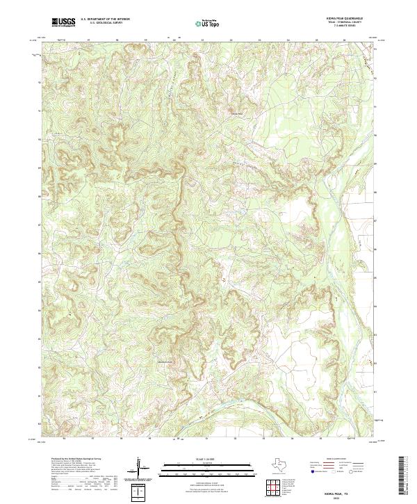
2022 Map of Kiowa Peak
USGS Topo · Published 2022About this map
Kiowa Peak rises as a prominent landmark in this portion of Stonewall County, where the convergence of major waterways shapes the West Texas terrain. The landscape is defined by the meeting of the Brazos River, the Salt Fork Brazos River, and the Double Mountain Fork Brazos River in the southeast. These rivers are fed by a complex network of drainages including Wedington Cr and Wilfong Cr, which cut through deep breaks like Smelter Canyon and Panther Canyon. Sparse ranch roads such as C R 235 and C R 225 navigate the high ground between Davidson Peak and the river bottoms. Local water sources, notably Beaver Springs and Keller Lake, provide critical points of interest in an otherwise arid expanse dominated by topographic relief and seasonal stream beds.
Find a feature on this map
20 named features on this map. Tap any name to fly to it.
Don’t see what you’re looking for? This feature index may not catch every label — zoom into the map to look around manually.
Map Details
Editions of this 2022 Kiowa Peak Map
This is the sole edition of this map. No revisions or reprints were ever made.
Other maps of this area

1925 · Aspermont 4-a
USGS Topo · 1:48,000

1925 · Haskell 3-b
USGS Topo · 1:48,000

1931 · Aspermont
USGS Topo · 1:62,500

1954 · Lubbock
USGS Topo · 1:250,000

1954 · Wichita Falls
USGS Topo · 1:250,000

1958 · Wichita Falls
USGS Topo · 1:250,000

1962 · Kiowa Peak
USGS Topo · 1:24,000

1965 · Jud
USGS Topo · 1:24,000

1967 · Knox City NW
USGS Topo · 1:24,000

1967 · Kiowa Peak NW
USGS Topo · 1:24,000