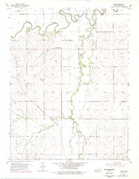
1955 Map of Kipp
USGS Topo · Published 1978About this map
The Smoky Hill River winds across the northern reaches of this Saline County landscape, defining the agricultural character of the region. The small settlement of Kipp serves as a local hub, situated along the Missouri Pacific railroad line which cuts diagonally across the southern plains. This 1955 survey, with later 1970s revisions, reveals a rural fabric anchored by local institutions like the Mt Tabor Sch (Abandoned) and established burying grounds including Donmyer Cem and Poheta Cem. The drainage pattern is dominated by the serpentine Gypsum Creek, which receives several tributaries including the West Branch and Spring Creek. The map provides a clear look at the township structure during the mid-20th century, showing the intersection of Cambria, Dayton, Greeley, Solomon, Walnut, and Eureka boundaries.
Find a feature on this map
18 named features on this map. Tap any name to fly to it.
Don’t see what you’re looking for? This feature index may not catch every label — zoom into the map to look around manually.
Map Details
Editions of this 1955 Kipp Map
2 editions found
Other maps of this area

1889 · Abilene
USGS Topo · 1:125,000

1892 · Salina
USGS Topo · 1:125,000

1894 · Abilene
USGS Topo · 1:125,000

1942 · Salina
USGS Topo · 1:125,000

1955 · Salina
USGS Topo · 1:24,000

1955 · Assaria
USGS Topo · 1:24,000

1955 · Niles
USGS Topo · 1:24,000

1955 · New Cambria
USGS Topo · 1:24,000

1955 · Kipp
USGS Topo · 1:24,000

1955 · Gypsum
USGS Topo · 1:24,000