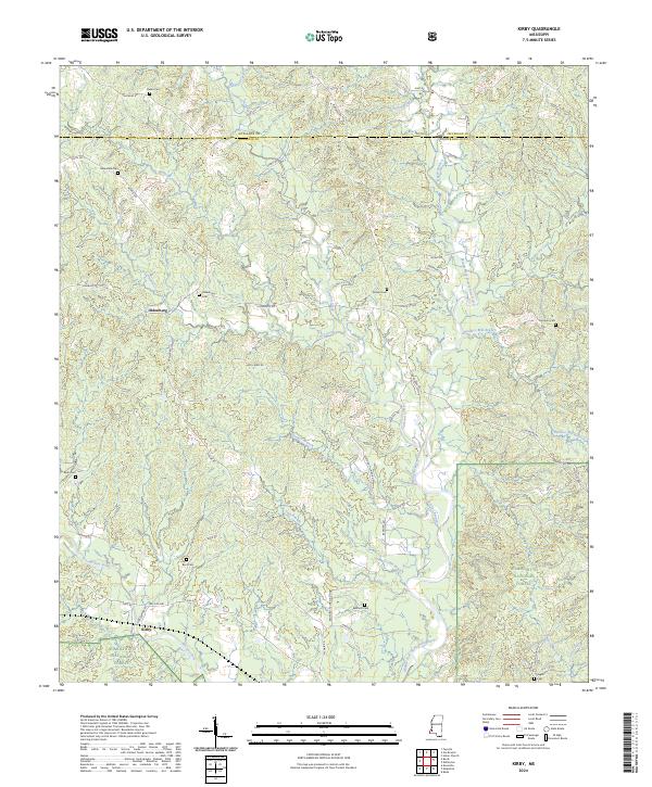
2024 Map of Kirby
USGS Topo · Published 2024About this map
Oldenburg and Kirby serve as the primary focal points of this rural landscape in southwestern Mississippi, where the headwaters of the Middle Fork Homochitto River and Morgan Fork carve through the terrain. The map documents a significant portion of the Homochitto National Forest in the southeast, contrasting the dense woodlands with the organized agricultural plots and timberlands to the north. A high density of family-named cemeteries, including Greendale Cem, Sixteen Cem, and Mormon Cem, suggests a deeply rooted local genealogy and a history of small, dispersed communities linked by a network of rural roads such as Oldenburg Rd and McNair Rd. The county line between Jefferson and Franklin counties runs east-to-west across the northern section, marking a political boundary in a landscape otherwise defined by drainage patterns like Guice Creek and Cameron Creek.
Find a feature on this map
67 named features on this map. Tap any name to fly to it.
Don’t see what you’re looking for? This feature index may not catch every label — zoom into the map to look around manually.
Map Details
Editions of this 2024 Kirby Map
This is the sole edition of this map. No revisions or reprints were ever made.
Other maps of this area

1953 · Natchez
USGS Topo · 1:250,000

1956 · Natchez
USGS Topo · 1:250,000

1959 · Natchez
USGS Topo · 1:250,000

1961 · Crosby
USGS Topo · 1:62,500

1962 · Fayette
USGS Topo · 1:62,500

1962 · Bude
USGS Topo · 1:62,500

1963 · Union Church
USGS Topo · 1:62,500
1984 · Natchez
USGS Topo · 1:100,000

1984 · Brookhaven
USGS Topo · 1:100,000

1984 · McComb
USGS Topo · 1:100,000