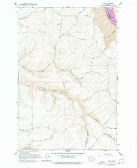
1964 Map of Kirby
USGS Topo · Published 1977About this map
Kirby serves as a focal point for this survey of the northern Garfield County landscape, where the plateau of Camas Prairie drops sharply toward the Snake River. The terrain is deeply incised by a complex drainage system including Deadman Gulch and South Fork Deadman Gulch, reflecting the topographic challenges faced by early settlers. A notable feature of the riverfront area is Lower Granite Lake, while the upland areas are marked by a network of winding paths such as Kirby Mayview Road and Chapel Hill Road.
Find a feature on this map
33 named features on this map. Tap any name to fly to it.
Don’t see what you’re looking for? This feature index may not catch every label — zoom into the map to look around manually.
Map Details
Editions of this 1964 Kirby Map
2 editions found
Other maps of this area

1910 · Pullman
USGS Topo · 1:125,000

1937 · Pomeroy
USGS Topo · 1:96,000

1942 · Pomeroy
USGS Topo · 1:125,000

1943 · Peola
USGS Topo · 1:62,500

1946 · Peola
USGS Topo · 1:62,500

1950 · Penawawa
USGS Topo · 1:62,500

1955 · Pullman
USGS Topo · 1:250,000

1958 · Pullman
USGS Topo · 1:250,000

1964 · Kirby
USGS Topo · 1:24,000

1964 · Ewartsville
USGS Topo · 1:24,000