
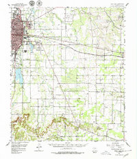
1957 Map of Kirby Lake
USGS Topo · Published 1958About this map
The growing city of Abilene dominates the northwestern corner of this mid-century landscape, characterized by its concentrated academic and institutional presence. Educational centers like Hardin-Simmons University, Abilene Christian College, and McMurry College define the city's northern and western edges, while the Abilene State Hospital and its associated Abilene State Hospital Cemetery mark the transition toward the rural southeast. The Texas and Pacific railroad and the Veterans World War II Memorial Highway provide the primary east-west corridors, passing through the Elmdale Oil Field and the town of Clyde.
Find a feature on this map
45 named features on this map. Tap any name to fly to it.
Don’t see what you’re looking for? This feature index may not catch every label — zoom into the map to look around manually.
Map Details
Editions of this 1957 Kirby Lake Map
2 editions found
Other maps of this area

1890 · Abilene
USGS Topo · 1:125,000

1891 · Anson
USGS Topo · 1:125,000

1892 · Abilene
USGS Topo · 1:125,000

1892 · Albany
USGS Topo · 1:125,000

1893 · Albany
USGS Topo · 1:125,000

1893 · Anson
USGS Topo · 1:125,000

1931 · Baird
USGS Topo · 1:125,000

1932 · Baird
USGS Topo · 1:125,000

1954 · Abilene
USGS Topo · 1:250,000

1957 · Hawley
USGS Topo · 1:62,500