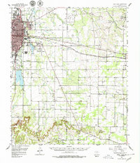
1957 Map of Kirby Lake
USGS Topo · Published 1979About this map
The expanding city of Abilene and its eastern agricultural and petroleum fringes are documented in this 1957 survey. The landscape is defined by the Texas and Pacific railroad corridor, which links the urban center to the town of Clyde and the Clyde Sta. This era captures a transition in local infrastructure, showing the Abilene Municipal Airport and the West Texas Fairground alongside established institutions like Abilene Christian College and the Abilene State Hospital.
Find a feature on this map
44 named features on this map. Tap any name to fly to it.
Don’t see what you’re looking for? This feature index may not catch every label — zoom into the map to look around manually.
Map Details
Editions of this 1957 Kirby Lake Map
2 editions found

Other maps of this area

1890 · Abilene
USGS Topo · 1:125,000

1891 · Anson
USGS Topo · 1:125,000

1892 · Abilene
USGS Topo · 1:125,000

1892 · Albany
USGS Topo · 1:125,000

1893 · Albany
USGS Topo · 1:125,000

1893 · Anson
USGS Topo · 1:125,000

1931 · Baird
USGS Topo · 1:125,000

1932 · Baird
USGS Topo · 1:125,000

1954 · Abilene
USGS Topo · 1:250,000

1957 · Hawley
USGS Topo · 1:62,500