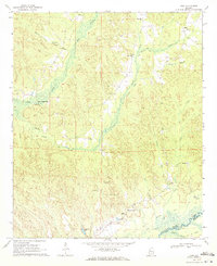
1970 Map of Kirk
USGS Topo · Published 1972About this map
Speeds Water Mill and a series of rural congregational hubs define the landscape of the Kirk quadrangle during the early 1970s. The terrain is deeply carved by the Sipsey River and its numerous tributaries, including Sneads Creek and Box Creek, which converge near the Pickens and Greene County line. The era's vanishing industrial footprint is visible through the Old Railroad Grade that winds through the hills, marking paths once vital for transport. Local life is centered around scattered community landmarks such as the Community Center and numerous small churches like Mars Hill Ch, Kenney Hill Ch, and Souls Chapel. The map also identifies specific family and historical sites, such as the Piney Grove Cem and a Lookout Tower, providing a detailed view of these rural Alabama townships before further modern development.
Find a feature on this map
29 named features on this map. Tap any name to fly to it.
Don’t see what you’re looking for? This feature index may not catch every label — zoom into the map to look around manually.
Map Details
Editions of this 1970 Kirk Map
2 editions found
Other maps of this area

1953 · Birmingham
USGS Topo · 1:250,000

1953 · West Point
USGS Topo · 1:250,000

1956 · Birmingham
USGS Topo · 1:250,000

1957 · Birmingham
USGS Topo · 1:250,000

1958 · West Point
USGS Topo · 1:250,000

1963 · West Point
USGS Topo · 1:250,000

1967 · Carrollton
USGS Topo · 1:24,000

1967 · Gordo
USGS Topo · 1:24,000

1967 · Elrod
USGS Topo · 1:24,000
1970 · Romulus
USGS Topo · 1:24,000