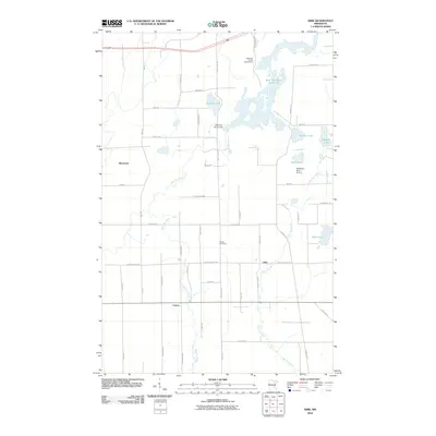
2010 Map of Kirk
USGS Topo · Published 2010About this map
West Two River Reservoir dominates the northern landscape of this Iron Range quadrangle, managed by the West Two Rivers Dam and supporting recreation at the West Two Rivers Campground. The terrain is defined by the convergence of the West Two River and East Two River systems, which wind through a grid of rural roads named for early local families such as Nelson Rd, Nurmi Rd, and Tamminen Rd. Small rural clusters like Kirk and Cherry serve as focal points for the surrounding agricultural and residential plots, while the Bethel Cemetery offers a point of interest for genealogical research. The presence of the Stahlberg-Mohr Airport near Silver Lake and Kendall Lake highlights the infrastructure supporting this pocket of Saint Louis County during the early 21st century.
Find a feature on this map
46 named features on this map. Tap any name to fly to it.
Don’t see what you’re looking for? This feature index may not catch every label — zoom into the map to look around manually.
Map Details
Editions of this 2010 Kirk Map
This is the sole edition of this map. No revisions or reprints were ever made.
Other maps of this area

1951 · Eveleth
USGS Topo · 1:24,000

1951 · Virginia
USGS Topo · 1:24,000

1951 · Kinney
USGS Topo · 1:24,000

1951 · Kirk
USGS Topo · 1:24,000

1951 · Zim
USGS Topo · 1:24,000

1951 · Casco
USGS Topo · 1:24,000

1951 · Buhl
USGS Topo · 1:24,000

1952 · Little Swan
USGS Topo · 1:24,000

1954 · Hibbing
USGS Topo · 1:250,000

1955 · Dewey Lake SE
USGS Topo · 1:24,000