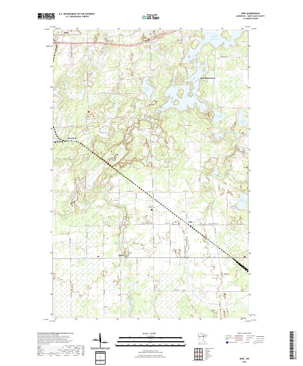
2022 Map of Kirk
USGS Topo · Published 2022About this map
West Two River Reservoir dominates the northern reaches of this St. Louis County landscape, serving as a focal point for the surrounding settlements of Mountain Iron and Buhl. The map details a transition from the industrial character of the Iron Range to the wetland-rich topography of the south, where the West Two River and E Two River meander through complex marshlands. Small residential clusters like Sherwood, Kirk, and Cherry are connected by a network of county roads including CO Hwy 25 and CO Rd 592. Genealogists and local historians will find the Cherry-Clinton Cem centrally located near the junction of Spirit Lake Rd and Iron Junction Rd. The abundance of smaller water bodies such as Doherty Lake, Kendall Lake, and Majestic Lake highlights the glaciated terrain of the Mesabi region in the early 21st century.
Find a feature on this map
65 named features on this map. Tap any name to fly to it.
Don’t see what you’re looking for? This feature index may not catch every label — zoom into the map to look around manually.
Map Details
Editions of this 2022 Kirk Map
This is the sole edition of this map. No revisions or reprints were ever made.
Other maps of this area

1951 · Eveleth
USGS Topo · 1:24,000

1951 · Virginia
USGS Topo · 1:24,000

1951 · Kinney
USGS Topo · 1:24,000

1951 · Kirk
USGS Topo · 1:24,000

1951 · Zim
USGS Topo · 1:24,000

1951 · Casco
USGS Topo · 1:24,000

1951 · Buhl
USGS Topo · 1:24,000

1952 · Little Swan
USGS Topo · 1:24,000

1954 · Hibbing
USGS Topo · 1:250,000

1955 · Dewey Lake SE
USGS Topo · 1:24,000