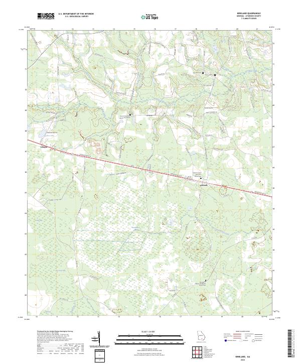
2024 Map of Kirkland
USGS Topo · Published 2024About this map
Kirkland sits as a central point in this Atkinson County landscape, where the corridor of Atkinson Blvd W connects small settlements across a terrain defined by extensive wetlands and slow-moving water. The geography is dominated by large cypress-filled depressions and swampy basins like Roundabout Swamp, Hog Creek Bay, and Dark Bay, which influence the winding paths of rural routes such as Antioch Church Rd and Lazy Nine Rd. These natural features have historically shaped the distribution of community life, leaving a trail of family-named landmarks and country congregations.
Find a feature on this map
74 named features on this map. Tap any name to fly to it.
Don’t see what you’re looking for? This feature index may not catch every label — zoom into the map to look around manually.
Map Details
Editions of this 2024 Kirkland Map
This is the sole edition of this map. No revisions or reprints were ever made.
Other maps of this area

1953 · Waycross
USGS Topo · 1:250,000

1958 · Waycross
USGS Topo · 1:250,000

1971 · Douglas South
USGS Topo · 1:24,000

1971 · Pearson
USGS Topo · 1:24,000

1972 · Kirkland
USGS Topo · 1:24,000

1972 · Willacoochee
USGS Topo · 1:24,000

1972 · Lax
USGS Topo · 1:24,000

1972 · Sandy Bottom
USGS Topo · 1:24,000

1972 · Henderson Still
USGS Topo · 1:24,000

1972 · Mora
USGS Topo · 1:24,000