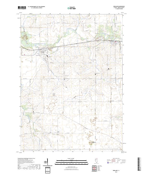
2024 Map of Kirkland
USGS Topo · Published 2024About this map
Kirkland and Kingston serve as the primary population centers in this agricultural corridor along the South Branch Kishwaukee River. The landscape is a network of rural townships defined by historic cemeteries such as Pine Hill Cem and Mayfield Cem, which offer significant genealogical markers for the region. Small rail-aligned settlements like Clare and Wilkinson reflect the late-nineteenth-century development of DeKalb County's interior, while the presence of Harold Bunger Airport south of town indicates the modernization of local transport. Numerous waterways, including Kingsbury Creek and Bull Run, dissect the flat prairie land, influencing the placement of early farmsteads and road layouts like Glidden Rd and Wolf Rd.
Find a feature on this map
64 named features on this map. Tap any name to fly to it.
Don’t see what you’re looking for? This feature index may not catch every label — zoom into the map to look around manually.
Map Details
Editions of this 2024 Kirkland Map
This is the sole edition of this map. No revisions or reprints were ever made.
Other maps of this area

1918 · Kirkland
USGS Topo · 1:62,500

1934 · De Kalb
USGS Topo · 1:62,500

1937 · De Kalb
USGS Topo · 1:62,500

1937 · Sycamore
USGS Topo · 1:62,500

1938 · Genoa
USGS Topo · 1:62,500

1954 · Rockford
USGS Topo · 1:250,000

1955 · Rockford
USGS Topo · 1:250,000

1958 · Aurora
USGS Topo · 1:250,000

1958 · Rockford
USGS Topo · 1:250,000

1961 · Aurora
USGS Topo · 1:250,000