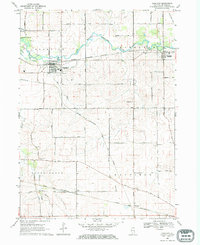
1968 Map of Kirkland
USGS Topo · Published 1970About this map
The Kishwaukee River and its South Branch define the northern landscape of this DeKalb County region, where the Chicago Milwaukee St Paul and Pacific railroad serves the established communities of Kirkland and Kingston. This late-1960s survey illustrates a mature agricultural grid interrupted by these river valleys and a secondary rail corridor, the Chicago and North Western, which passes through the southern hamlets of Clare and Wilkinson.
Find a feature on this map
50 named features on this map. Tap any name to fly to it.
Don’t see what you’re looking for? This feature index may not catch every label — zoom into the map to look around manually.
Map Details
Editions of this 1968 Kirkland Map
This is the sole edition of this map. No revisions or reprints were ever made.
Other maps of this area

1918 · Kirkland
USGS Topo · 1:62,500

1934 · De Kalb
USGS Topo · 1:62,500

1937 · De Kalb
USGS Topo · 1:62,500

1937 · Sycamore
USGS Topo · 1:62,500

1938 · Genoa
USGS Topo · 1:62,500

1954 · Rockford
USGS Topo · 1:250,000

1955 · Rockford
USGS Topo · 1:250,000

1958 · Aurora
USGS Topo · 1:250,000

1958 · Rockford
USGS Topo · 1:250,000

1961 · Aurora
USGS Topo · 1:250,000