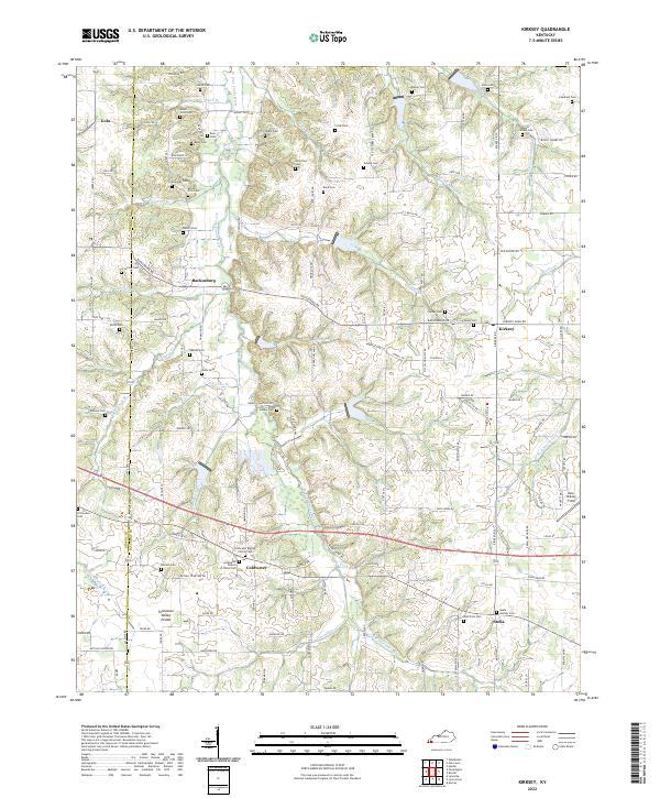
2022 Map of Kirksey
USGS Topo · Published 2022About this map
The Tennessee Valley Divide cuts through this portion of western Kentucky, separating the drainage systems of the W Fork Clarks River from the smaller creeks that flow westward toward the Mississippi. This rural landscape is defined by its small crossroads settlements, including Backusburg, Kirksey, and Coldwater, each serving as a focal point for the surrounding agricultural community. The map reveals a dense network of family and community history, evidenced by numerous burial grounds such as the Scherffius Cem and Collie Cem scattered across the uplands.
Find a feature on this map
88 named features on this map. Tap any name to fly to it.
Don’t see what you’re looking for? This feature index may not catch every label — zoom into the map to look around manually.
Map Details
Editions of this 2022 Kirksey Map
This is the sole edition of this map. No revisions or reprints were ever made.
Other maps of this area

1936 · Farmington
USGS Topo · 1:24,000

1936 · Hazel
USGS Topo · 1:24,000

1936 · Oak Level
USGS Topo · 1:24,000

1936 · Lynn Grove
USGS Topo · 1:24,000

1936 · Hardin
USGS Topo · 1:24,000

1936 · Benton
USGS Topo · 1:48,000

1936 · Westplains
USGS Topo · 1:24,000

1936 · Dexter
USGS Topo · 1:24,000

1936 · Kirksey
USGS Topo · 1:24,000
1951 · Hardin
USGS Topo · 1:24,000