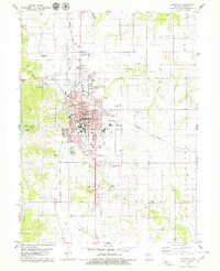
1979 Map of Kirksville
USGS Topo · Published 1979About this map
Kirksville stands as a significant educational and medical hub in late 1970s Adair County, anchored by the sprawling campuses of Northeast Mo State University and the Kirksville College of Osteopathic Med. The town's grid is dense with civic infrastructure, including the central Courthouse, City Hall, and several specialized schools like the Voc Tech Sch and Greenwood Sch. The surrounding landscape is defined by the convergence of the Norfolk and Western and Burlington Northern railroads, illustrating the area's continued importance as a regional transportation junction.
Find a feature on this map
47 named features on this map. Tap any name to fly to it.
Don’t see what you’re looking for? This feature index may not catch every label — zoom into the map to look around manually.
Map Details
Editions of this 1979 Kirksville Map
2 editions found
Other maps of this area

1903 · Edina
USGS Topo · 1:125,000

1911 · Queen City
USGS Topo · 1:62,500

1913 · Queen City
USGS Topo · 1:62,500

1938 · Kirksville
USGS Topo · 1:62,500

1940 · Kirksville
USGS Topo · 1:62,500

1954 · Centerville
USGS Topo · 1:250,000

1957 · Centerville
USGS Topo · 1:250,000

1958 · Centerville
USGS Topo · 1:250,000

1966 · Brashear
USGS Topo · 1:24,000
1966 · Willmathsville
USGS Topo · 1:24,000