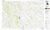
1981 Map of Kirksville
USGS Topo · Published 1982About this map
Kirksville anchors this Northeast Missouri landscape, serving as a regional hub defined by the Kirksville College of Osteopathic Med and the sprawling waters of Thousand Hills State Park. The 1980s terrain is heavily influenced by the Chariton River and its various tributaries, while industrial activity is evident in the Strip Mines found in the western reaches near Sugar Creek State Forest.
Find a feature on this map
128 named features on this map. Tap any name to fly to it.
Don’t see what you’re looking for? This feature index may not catch every label — zoom into the map to look around manually.
Map Details
Editions of this 1981 Kirksville Map
This is the sole edition of this map. No revisions or reprints were ever made.
Other maps of this area

1903 · Kahoka
USGS Topo · 1:125,000

1903 · Palmyra
USGS Topo · 1:125,000

1903 · Edina
USGS Topo · 1:125,000

1908 · Atlanta
USGS Topo · 1:62,500

1911 · Queen City
USGS Topo · 1:62,500

1912 · Green City
USGS Topo · 1:62,500

1913 · Queen City
USGS Topo · 1:62,500

1914 · Green City
USGS Topo · 1:62,500

1937 · Elmer
USGS Topo · 1:48,000

1938 · Kirksville
USGS Topo · 1:62,500