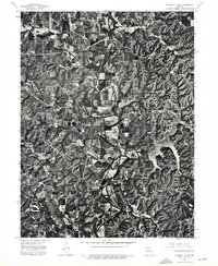
1974 Map of Kirksville NW
USGS Topo · Published 1976About this map
Novinger and Youngstown anchor this mid-1970s orthophotoquad, which provides a direct aerial perspective of the rural landscape northwest of Kirksville. The imagery highlights the winding path of the Chariton River as it snakes through a patchwork of agricultural fields and wooded bottomlands. To the east, the irregular, branching fingers of Forest Lake reach into the upland terrain, illustrating the relationship between the local topography and water management in Adair County. This aerial survey captures the specific land-use patterns of the era, from the grid-like residential clusters in Novinger to the expansive timbered ridges that define the area's geography. Researchers can observe the exact footprint of farmsteads and transport routes as they existed during this specific spring flight.
Find a feature on this map
4 named features on this map. Tap any name to fly to it.
Don’t see what you’re looking for? This feature index may not catch every label — zoom into the map to look around manually.
Map Details
Editions of this 1974 Kirksville NW Map
This is the sole edition of this map. No revisions or reprints were ever made.
Other maps of this area

1911 · Queen City
USGS Topo · 1:62,500

1912 · Green City
USGS Topo · 1:62,500

1913 · Queen City
USGS Topo · 1:62,500

1914 · Green City
USGS Topo · 1:62,500

1938 · Kirksville
USGS Topo · 1:62,500

1940 · Kirksville
USGS Topo · 1:62,500

1954 · Centerville
USGS Topo · 1:250,000

1957 · Centerville
USGS Topo · 1:250,000

1958 · Centerville
USGS Topo · 1:250,000

1963 · Pure Air
USGS Topo · 1:24,000