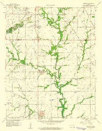
1959 Map of Kirkwood
USGS Topo · Published 1960About this map
The borderlands of Crawford and Cherokee counties reveal an industrial landscape transitioning from deep mining to surface operations in the late 1950s. Extensive Strip Mines dominate the northern terrain around Kirkwood, Atlas, and Kramer, where the St Louis San Francisco railroad network once supported heavy extractive activity. Southward, the map shifts into the more agrarian township of Pleasant View, where the landscape is defined by the winding course of East Cow Creek and Cow Creek.
Find a feature on this map
30 named features on this map. Tap any name to fly to it.
Don’t see what you’re looking for? This feature index may not catch every label — zoom into the map to look around manually.
Map Details
Editions of this 1959 Kirkwood Map
2 editions found
Other maps of this area

1886 · Joplin
USGS Topo · 1:125,000

1894 · Joplin
USGS Topo · 1:125,000

1918 · Columbus
USGS Topo · 1:62,500

1943 · Cherokee
USGS Topo · 1:62,500

1945 · Pittsburg
USGS Topo · 1:62,500

1945 · Cherokee
USGS Topo · 1:62,500

1947 · Joplin
USGS Topo · 1:250,000

1947 · Pittsburg
USGS Topo · 1:62,500

1949 · Joplin
USGS Topo · 1:250,000

1950 · Pittsburg
USGS Topo · 1:62,500