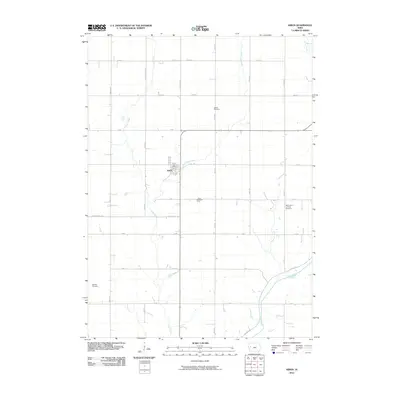
2010 Map of Kiron
USGS Topo · Published 2010About this map
Kiron serves as the primary hub of this agricultural landscape in the early 21st century, centered at the intersection of Country Hwy M31 and B Ave. The settlement is anchored by the Kiron Post Office and surrounded by a network of well-defined section roads that mirror the orderly township system. For genealogists, the map is particularly rich in burial sites, documenting Bethel Cemetery to the north, the Kiron Cemetery just south of town, and Saint Johns Lutheran Cemetery to the southeast. The terrain is shaped by the drainage patterns of Otter Creek and its tributary East Otter Creek, which flow toward the Boyer River in the southern portion of the quadrangle. This detailed survey preserves the spatial relationship between these rural landmarks and the waterways that historically influenced the placement of farms and small local cemeteries like Lohfeld Cemetery.
Find a feature on this map
33 named features on this map. Tap any name to fly to it.
Don’t see what you’re looking for? This feature index may not catch every label — zoom into the map to look around manually.
Map Details
Editions of this 2010 Kiron Map
This is the sole edition of this map. No revisions or reprints were ever made.
Other maps of this area

1954 · Fort Dodge
USGS Topo · 1:250,000

1957 · Fort Dodge
USGS Topo · 1:250,000

1958 · Fort Dodge
USGS Topo · 1:250,000

1967 · Ida Grove
USGS Topo · 1:24,000

1971 · Schleswig
USGS Topo · 1:24,000

1971 · Denison
USGS Topo · 1:24,000
1971 · Denison SW
USGS Topo · 1:24,000

1971 · Kiron
USGS Topo · 1:24,000

1980 · Odebolt East
USGS Topo · 1:24,000

1980 · Boyer
USGS Topo · 1:24,000