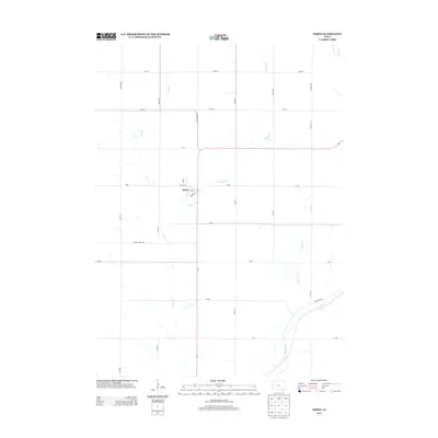
2013 Map of Kiron
USGS Topo · Published 2013About this map
Kiron serves as the central hub of this agricultural landscape in Crawford County, defined by a rigid grid of section roads and the winding paths of several waterways. The town's small street network, featuring Lime St, Timothy St, and Eureka St, sits at the intersection of local commerce and transport. The drainage of the region is dominated by the Otter Creek system, including E Otter Creek, which meanders across the northern and central portions of the quadrangle. To the southeast, the Boyer River cuts a wider path through the terrain, accompanied by Newcom Creek and Boyer Boulevard. This map illustrates the intersection of a modernized rural road system with the natural hydrology that has long shaped farming in western Iowa.
Find a feature on this map
33 named features on this map. Tap any name to fly to it.
Don’t see what you’re looking for? This feature index may not catch every label — zoom into the map to look around manually.
Map Details
Editions of this 2013 Kiron Map
This is the sole edition of this map. No revisions or reprints were ever made.
Other maps of this area

1954 · Fort Dodge
USGS Topo · 1:250,000

1957 · Fort Dodge
USGS Topo · 1:250,000

1958 · Fort Dodge
USGS Topo · 1:250,000

1967 · Ida Grove
USGS Topo · 1:24,000

1971 · Schleswig
USGS Topo · 1:24,000

1971 · Denison
USGS Topo · 1:24,000
1971 · Denison SW
USGS Topo · 1:24,000

1971 · Kiron
USGS Topo · 1:24,000

1980 · Odebolt East
USGS Topo · 1:24,000

1980 · Boyer
USGS Topo · 1:24,000