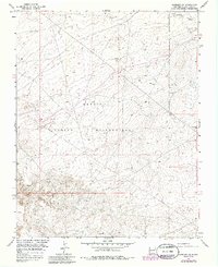
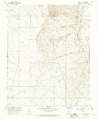
1966 Map of Kirtland SE
USGS Topo · Published 1986About this map
The Navajo Indian Reservation landscape is defined by its industrial and topographical features in this mid-1960s study, later updated with photorevisions in the late 1970s. The terrain is marked by the deep cut of Ojo Amarillo Canyon in the northeast, while the rest of the quadrangle reveals a network of resource extraction and infrastructure. Numerous sites labeled as Drill Hole and Gas Well are scattered across the high desert, indicating a period of significant geological exploration and energy development.
Find a feature on this map
10 named features on this map. Tap any name to fly to it.
Don’t see what you’re looking for? This feature index may not catch every label — zoom into the map to look around manually.
Map Details
Editions of this 1966 Kirtland SE Map
3 editions found
Other maps of this area

1889 · Chaco
USGS Topo · 1:250,000

1892 · Chaco
USGS Topo · 1:250,000

1927 · Sulphur Spring
USGS Topo · 1:96,000

1928 · Kirtland
USGS Topo · 1:125,000

1932 · Kirtland
USGS Topo · 1:125,000

1954 · Shiprock
USGS Topo · 1:250,000

1958 · Shiprock
USGS Topo · 1:250,000

1959 · Shiprock
USGS Topo · 1:250,000
1965 · Farmington South
USGS Topo · 1:24,000
1965 · Hugh Lake
USGS Topo · 1:24,000