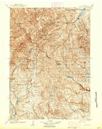
1906 Map of Kirwin
USGS Topo · Published 1938About this map
Kirwin stands as a focal point in the upper reaches of the Wood River drainage, situated among the high peaks of the Absaroka Mountains. Surveyed by T.M. Bannon and his team in the early 1900s, this area reflects the early resource extraction and ranching character of the Wyoming frontier. The presence of the Gold Reef Tunnel and Spar Mtn indicates the mining interests that drove settlement into these high altitudes, while multiple timber operations such as Dicks Sawmill supported local construction and infrastructure.
Find a feature on this map
71 named features on this map. Tap any name to fly to it.
Don’t see what you’re looking for? This feature index may not catch every label — zoom into the map to look around manually.
Map Details
Editions of this 1906 Kirwin Map
2 editions found
Other maps of this area

1893 · Ishawooa
USGS Topo · 1:125,000

1895 · Ishawooa
USGS Topo · 1:125,000

1899 · Ishawooa
USGS Topo · 1:125,000

1904 · Kirwin
USGS Topo · 1:125,000

1905 · Younts Peak
USGS Topo · 1:125,000

1906 · Kirwin
USGS Topo · 1:125,000

1907 · Younts Peak
USGS Topo · 1:125,000

1909 · Fremont Peak
USGS Topo · 1:125,000

1911 · Meeteetse
USGS Topo · 1:62,500

1913 · Meeteetse
USGS Topo · 1:62,500