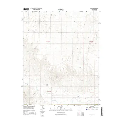
2016 Map of Kismet SE
USGS Topo · Published 2016About this map
The Cimarron River carves through the southern landscape of the Beaver County and Meade County border, creating a series of dramatic geographic breaks including Wolf Canyon, Keefe Canyon, and Fox Canyon. This 2016 survey captures a high-plains environment defined by large-scale section-line roads such as Z RD and Aa RD, which reflect the systematic grid of the Public Land Survey System. In the northern reaches, the isolated West Glendale Cem serves as a quiet marker of early regional settlement, situated near the distinctive Twin Hills. The transition from the flat tablelands, exemplified by Table Mesa, to the eroded river valley highlights the rugged drainage patterns that have historically dictated land use and travel in this portion of the Oklahoma Panhandle.
Find a feature on this map
20 named features on this map. Tap any name to fly to it.
Don’t see what you’re looking for? This feature index may not catch every label — zoom into the map to look around manually.
Map Details
Editions of this 2016 Kismet SE Map
This is the sole edition of this map. No revisions or reprints were ever made.
Other maps of this area

1892 · Meade
USGS Topo · 1:125,000

1954 · Perryton
USGS Topo · 1:250,000

1955 · Dodge City
USGS Topo · 1:250,000

1958 · Perryton
USGS Topo · 1:250,000

1958 · Dodge City
USGS Topo · 1:250,000

1959 · Dodge City
USGS Topo · 1:250,000

1963 · Kismet SE
USGS Topo · 1:24,000

1963 · Kismet NE
USGS Topo · 1:24,000

1963 · Lake Larrabee
USGS Topo · 1:24,000

1963 · Irish Flats
USGS Topo · 1:24,000