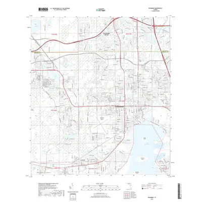
2018 Map of Kissimmee
USGS Topo · Published 2018About this map
The city of Kissimmee and its northern expansion into Hunters Creek dominate this 21st-century study of the Central Florida corridor. The landscape is defined by the intersection of major transit arteries like the W Osceola Pkwy and S Orange Blossom Trl, serving a rapidly suburbanized region that was once primarily agricultural. Aviation history and regional infrastructure are well-represented by the Kissimmee Gateway Airport and the smaller Stout Airport further south.
Find a feature on this map
38 named features on this map. Tap any name to fly to it.
Don’t see what you’re looking for? This feature index may not catch every label — zoom into the map to look around manually.
Map Details
Editions of this 2018 Kissimmee Map
This is the sole edition of this map. No revisions or reprints were ever made.
Other maps of this area

1953 · Lake Jessamine
USGS Topo · 1:24,000

1953 · St Cloud North
USGS Topo · 1:24,000

1953 · St Cloud South
USGS Topo · 1:24,000

1953 · Lake Tohopekaliga
USGS Topo · 1:24,000

1953 · Pine Castle
USGS Topo · 1:24,000

1953 · Kissimmee
USGS Topo · 1:24,000

1953 · Windermere
USGS Topo · 1:24,000

1953 · Intercession City
USGS Topo · 1:24,000

1953 · Davenport
USGS Topo · 1:24,000

1955 · Orlando
USGS Topo · 1:250,000