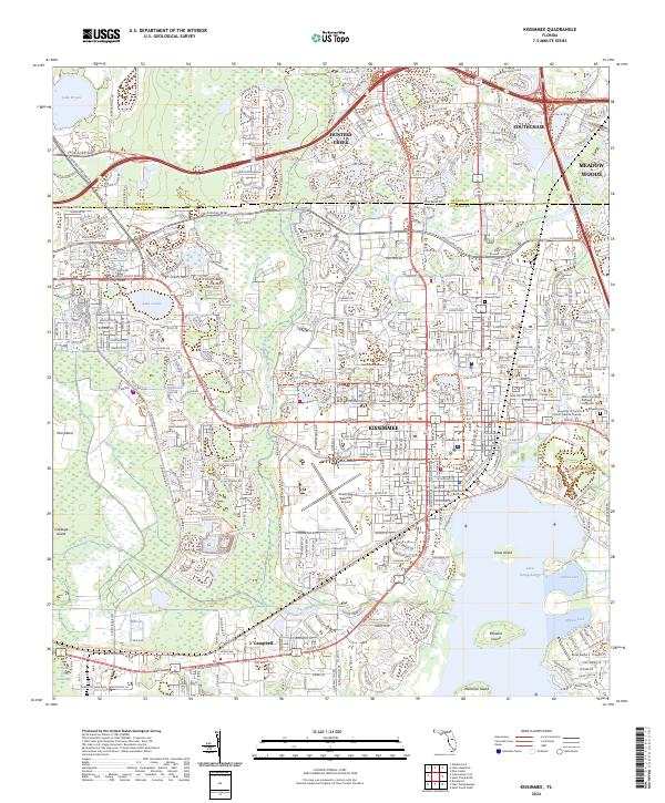
2024 Map of Kissimmee
USGS Topo · Published 2024About this map
Kissimmee and its surrounding wetlands are documented here at a moment of significant infrastructure expansion along the boundary of Orange Co and Osceola Co. The map detail traces the dense residential and commercial growth in Hunters Creek and Southchase, while maintaining the distinct hydrological identity of the region. The northern shores of Lake Tohopekaliga reveal a complex network of recreation and transport, including the Florida National Scenic Trail and the Kissimmee Gateway Airport. Cultural and educational anchors like the Osceola County Courthouse and Valencia College Osceola Campus sit within the established street grid, providing a clear reference for local historians. Moving south toward Campbell, the landscape transitions from urban development to the open waters and named islands of the lake, including Paradise Island and Makinson Island, where Shingle Creek empties into the basin.
Find a feature on this map
39 named features on this map. Tap any name to fly to it.
Don’t see what you’re looking for? This feature index may not catch every label — zoom into the map to look around manually.
Map Details
Editions of this 2024 Kissimmee Map
This is the sole edition of this map. No revisions or reprints were ever made.
Other maps of this area

1953 · Lake Jessamine
USGS Topo · 1:24,000

1953 · St Cloud North
USGS Topo · 1:24,000

1953 · St Cloud South
USGS Topo · 1:24,000

1953 · Lake Tohopekaliga
USGS Topo · 1:24,000

1953 · Pine Castle
USGS Topo · 1:24,000

1953 · Kissimmee
USGS Topo · 1:24,000

1953 · Windermere
USGS Topo · 1:24,000

1953 · Intercession City
USGS Topo · 1:24,000

1953 · Davenport
USGS Topo · 1:24,000

1955 · Orlando
USGS Topo · 1:250,000