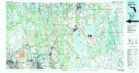
1979 Map of Kissimmee
USGS Topo · Published 1980About this map
Walt Disney World and the burgeoning suburban corridors of Central Florida define this 1979 survey, capturing a landscape in rapid transition. While massive development centers on the Orlando International Airport and the north, the map reveals the intricate hydrology of the region, anchored by the massive Lake Tohopekaliga and East Lake Tohopekaliga. Further west, the heavy industrial footprint of Strip Mines near Lakeland and Auburndale contrasts with the preserved wilderness of the Green Swamp and Withlacoochee State Forest. Smaller settlements like Narcoossee, Holopaw, and Dundee are shown alongside the extensive rail network of the Seaboard Coast Line, illustrating how older agricultural and transit patterns persisted even as tourism and aviation began to reshape the region's economy and settlement footprint.
Find a feature on this map
151 named features on this map. Tap any name to fly to it.
Don’t see what you’re looking for? This feature index may not catch every label — zoom into the map to look around manually.
Map Details
Editions of this 1979 Kissimmee Map
This is the sole edition of this map. No revisions or reprints were ever made.
Other maps of this area

1944 · Plant City
USGS Topo · 1:31,680

1944 · Providence
USGS Topo · 1:31,680

1944 · Polk City
USGS Topo · 1:31,680

1944 · Lakeland
USGS Topo · 1:31,680

1944 · Auburndale
USGS Topo · 1:31,680

1944 · Socrum
USGS Topo · 1:31,680

1949 · Mulberry
USGS Topo · 1:24,000

1949 · Bartow
USGS Topo · 1:24,000

1950 · Mulberry
USGS Topo · 1:24,000

1950 · Bartow
USGS Topo · 1:24,000