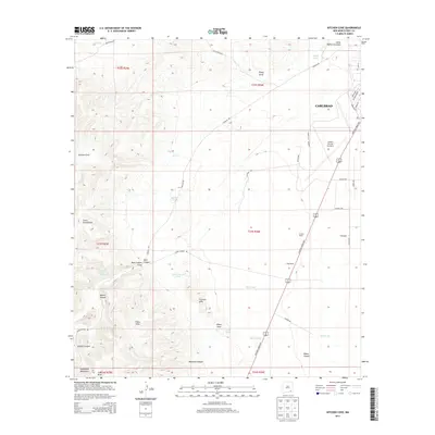
2013 Map of Kitchen Cove
USGS Topo · Published 2013About this map
The outskirts of Carlsbad meet the rugged foothills of the Guadalupe Mountains in this survey of Eddy County. The landscape is defined by its complex drainage network, where seasonal waterways like Dark Canyon Draw, Sheep Draw, and Elbow Canyon carve through the arid terrain. These draws are critical to the local ranching economy, as evidenced by the distribution of man-made water features such as Dark Canyon Tank, West Tank, and Kee Tank scattered across the township lines.
Find a feature on this map
49 named features on this map. Tap any name to fly to it.
Don’t see what you’re looking for? This feature index may not catch every label — zoom into the map to look around manually.
Map Details
Editions of this 2013 Kitchen Cove Map
This is the sole edition of this map. No revisions or reprints were ever made.
Other maps of this area

1939 · Carlsbad
USGS Topo · 1:62,500

1943 · Carlsbad
USGS Topo · 1:62,500

1943 · West Carlsbad
USGS Topo · 1:62,500

1945 · West Carlsbad
USGS Topo · 1:62,500

1945 · Carlsbad Caverns East
USGS Topo · 1:62,500

1945 · Malaga
USGS Topo · 1:62,500

1946 · Malaga
USGS Topo · 1:62,500

1947 · Carlsbad Caverns East
USGS Topo · 1:62,500

1954 · Carlsbad
USGS Topo · 1:250,000

1958 · Carlsbad
USGS Topo · 1:250,000