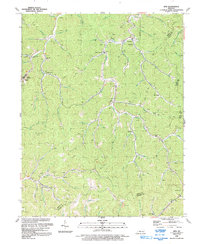
1992 Map of Kite
USGS Topo · Published 1992About this map
Alice Lloyd College and the community of Pippa Passes occupy the western narrow valleys of this Knott County landscape, where the topography is defined by the winding tributaries of Beaver Creek. During the early 1990s, the region's economy and physical layout remained deeply tied to the extraction of natural resources, evidenced by the numerous Mines and Oil Wells peppered across the ridgelines. Small settlements like Topmost, Kite, and Hall are situated along the creek floors, connected by a network of improved roads and rugged 4 WD trails that scale the steep gaps between watersheds.
Find a feature on this map
68 named features on this map. Tap any name to fly to it.
Don’t see what you’re looking for? This feature index may not catch every label — zoom into the map to look around manually.
Map Details
Editions of this 1992 Kite Map
This is the sole edition of this map. No revisions or reprints were ever made.
Other maps of this area

1890 · Whitesburg
USGS Topo · 1:125,000

1892 · Whitesburg
USGS Topo · 1:125,000

1912 · Pound
USGS Topo · 1:48,000

1912 · Hindman
USGS Topo · 1:48,000

1913 · Oven Fork
USGS Topo · 1:48,000

1914 · Pound
USGS Topo · 1:62,500

1914 · Vergie
USGS Topo · 1:48,000

1915 · Hindman
USGS Topo · 1:62,500

1915 · Whitesburg
USGS Topo · 1:62,500

1916 · Pikeville
USGS Topo · 1:62,500