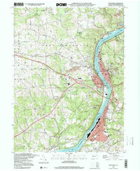
1998 Map of Kittanning
USGS Topo · Published 2000About this map
The Allegheny River corridor serves as the industrial and social spine of Armstrong County in the late 1990s, connecting a dense string of riverfront boroughs and settlements. Kittanning and Ford City anchor the region, with the river facilitating transit and resource movement through landmarks like the Gaging Sta and various gravel pits. The landscape transitions from the developed flats of Wick City and Applewold to the high ground of Pine Hill and Grandview.
Find a feature on this map
97 named features on this map. Tap any name to fly to it.
Don’t see what you’re looking for? This feature index may not catch every label — zoom into the map to look around manually.
Map Details
Editions of this 1998 Kittanning Map
This is the sole edition of this map. No revisions or reprints were ever made.
Other maps of this area

1900 · Kittanning
USGS Topo · 1:62,500

1901 · Rural Valley
USGS Topo · 1:62,500

1902 · Kittanning
USGS Topo · 1:62,500

1902 · Elders Ridge
USGS Topo · 1:62,500

1903 · Rural Valley
USGS Topo · 1:62,500

1904 · Elders Ridge
USGS Topo · 1:62,500

1907 · Freeport
USGS Topo · 1:62,500

1909 · Freeport
USGS Topo · 1:62,500

1953 · Pittsburgh
USGS Topo · 1:250,000
1953 · Freeport
USGS Topo · 1:24,000