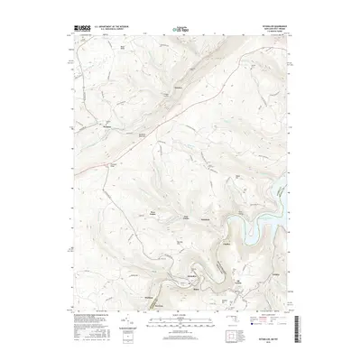
2016 Map of Kitzmiller
USGS Topo · Published 2016About this map
Kitzmiller and Blaine straddle the serpentine bend of the North Branch Potomac River, marking the border between Garrett County, Maryland and Mineral County, West Virginia. This rugged mountain corridor is defined by steep ridges like Backbone Mountain and Pheasant Ridge, which hem in a series of small mining and residential communities including Shallmar, West Vindex, and East Vindex. The landscape is heavily dissected by numerous runs and creeks, such as Three Forks Run and Crabtree Cr, which feed into the large expanse of Jennings Randolph Lake to the east.
Find a feature on this map
90 named features on this map. Tap any name to fly to it.
Don’t see what you’re looking for? This feature index may not catch every label — zoom into the map to look around manually.
Map Details
Editions of this 2016 Kitzmiller Map
This is the sole edition of this map. No revisions or reprints were ever made.
Other maps of this area

1895 · Piedmont
USGS Topo · 1:125,000

1899 · Grantsville
USGS Topo · 1:62,500

1899 · Oakland
USGS Topo · 1:62,500

1900 · Accident
USGS Topo · 1:62,500

1900 · Oakland
USGS Topo · 1:62,500

1904 · Grantsville
USGS Topo · 1:62,500

1919 · Elk Garden
USGS Topo · 1:48,000

1920 · Elk Garden
USGS Topo · 1:48,000

1922 · Elk Garden
USGS Topo · 1:62,500
1947 · Barton
USGS Topo · 1:24,000