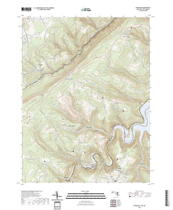
2023 Map of Kitzmiller
USGS Topo · Published 2023About this map
The North Branch Potomac River forms the state line between Garrett County, Maryland, and Mineral County, West Virginia, carving a deep valley through the heart of this Appalachian coal-mining district. Settlements like Kitzmiller, Blaine, and Shallmar huddle along the river banks, showing the characteristic linear development of industrial mountain towns. To the north, the terrain climbs toward Backbone Mountain and Pheasant Ridge, where the landscape is dotted with smaller mining camps such as West Vindex and East Vindex. This area is particularly rich for genealogical research, documenting numerous burial sites such as Rose Hill Cem, Tasker Cem, and Hamill Cem that serve the scattered rural communities. The map also records the presence of Jennings Randolph Lake, illustrating the more recent transition of this landscape toward water management and recreation.
Find a feature on this map
91 named features on this map. Tap any name to fly to it.
Don’t see what you’re looking for? This feature index may not catch every label — zoom into the map to look around manually.
Map Details
Editions of this 2023 Kitzmiller Map
This is the sole edition of this map. No revisions or reprints were ever made.
Other maps of this area

1895 · Piedmont
USGS Topo · 1:125,000

1899 · Grantsville
USGS Topo · 1:62,500

1899 · Oakland
USGS Topo · 1:62,500

1900 · Accident
USGS Topo · 1:62,500

1900 · Oakland
USGS Topo · 1:62,500

1904 · Grantsville
USGS Topo · 1:62,500

1919 · Elk Garden
USGS Topo · 1:48,000

1920 · Elk Garden
USGS Topo · 1:48,000

1922 · Elk Garden
USGS Topo · 1:62,500
1947 · Barton
USGS Topo · 1:24,000