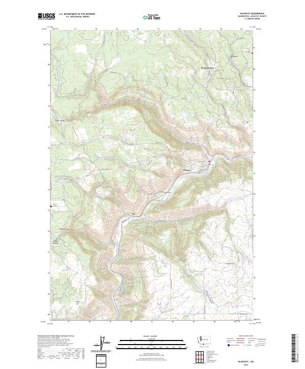
2023 Map of Klickitat
USGS Topo · Published 2023About this map
The Klickitat River carves a deep path through this portion of south-central Washington, dictating the development of settlements like Klickitat and Pitt. The river valley is flanked by dramatic elevation changes, leading to distinctive plateaus and named landmarks such as The Plateau, Long Butte, and Fisher Hill. The modern landscape reflects a transition from historic resource extraction to recreation, evidenced by the Woodruff Mill sitting north of the river and the Klickitat State Park Trail following the waterway's winding course. Smaller community hubs like High Prairie and the Pleasant Hill Cem provide essential anchor points for local history. The map also reveals numerous canyons and swales, such as Skookum Canyon and Snyder Swale, which have historically funneled travel and water through this complex volcanic terrain.
Find a feature on this map
53 named features on this map. Tap any name to fly to it.
Don’t see what you’re looking for? This feature index may not catch every label — zoom into the map to look around manually.
Map Details
Editions of this 2023 Klickitat Map
This is the sole edition of this map. No revisions or reprints were ever made.
Other maps of this area

1934 · The Dalles
USGS Topo · 1:125,000

1953 · The Dalles
USGS Topo · 1:250,000

1956 · The Dalles
USGS Topo · 1:250,000

1957 · The Dalles
USGS Topo · 1:250,000

1957 · Klickitat
USGS Topo · 1:62,500

1957 · The Dalles
USGS Topo · 1:62,500

1957 · White Salmon
USGS Topo · 1:62,500

1957 · Husum
USGS Topo · 1:62,500

1974 · Stacker Butte
USGS Topo · 1:24,000

1974 · The Dalles North
USGS Topo · 1:24,000