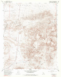
1967 Map of Klinker Mtn
USGS Topo · Published 1985About this map
Summit Diggings and a cluster of numerous unnamed Mines and a Gravel Pit mark the industrial activity of the northern Summit Range in this late 1960s survey. The landscape is defined by the high desert interface between the Lava Mountains and the flat expanse of Searles Valley to the north. Transportation history is deeply etched into the terrain, showing the path of the Southern Pacific railroad alongside an Old RR Grade and the Tunnel No 29 Grade.
Find a feature on this map
33 named features on this map. Tap any name to fly to it.
Don’t see what you’re looking for? This feature index may not catch every label — zoom into the map to look around manually.
Map Details
Editions of this 1967 Klinker Mtn Map
2 editions found
Other maps of this area

1903 · Randsburg
USGS Topo · 1:62,500

1911 · Randsburg
USGS Topo · 1:62,500

1912 · Randsburg
USGS Topo · 1:62,500

1915 · Searles Lake
USGS Topo · 1:250,000

1947 · Trona
USGS Topo · 1:250,000

1948 · Trona
USGS Topo · 1:250,000

1949 · Searles Lake
USGS Topo · 1:62,500

1950 · Searles Lake
USGS Topo · 1:62,500

1953 · Ridgecrest
USGS Topo · 1:62,500

1953 · Trona
USGS Topo · 1:250,000