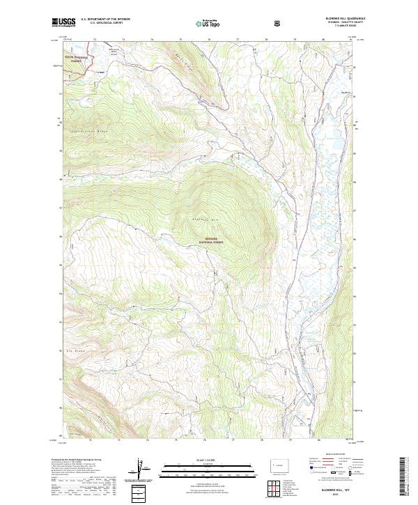
2021 Map of Klondike Hill
USGS Topo · Published 2021About this map
Green River headwaters dominate the eastern corridor of this high-elevation landscape, where the Bridger National Forest and Teton National Forest meet. The terrain is defined by massive topographic features like Bacon Ridge and Klondike Hill, interspersed with thermal features such as Kendall Warm Spring and Stinky Spring. This area is heavily mapped with winter recreation routes, including the S Snowmobile Trl and Cdit Snowmobile Trl, illustrating the modern management of this backcountry for seasonal access. The presence of the Kinky Creek Divide Airport in the northwest corner highlights the importance of remote aviation for fire management or forest access. Further south, the Whiskey Grove Cg sits near the confluence of Whiskey Cr and the main river, marking a established point for human activity in an otherwise roadless mountain environment.
Find a feature on this map
37 named features on this map. Tap any name to fly to it.
Don’t see what you’re looking for? This feature index may not catch every label — zoom into the map to look around manually.
Map Details
Editions of this 2021 Klondike Hill Map
This is the sole edition of this map. No revisions or reprints were ever made.
Other maps of this area

1907 · Gros Ventre
USGS Topo · 1:125,000

1909 · Fremont Peak
USGS Topo · 1:125,000

1910 · Gros Ventre
USGS Topo · 1:125,000

1955 · Driggs
USGS Topo · 1:250,000

1955 · Thermopolis
USGS Topo · 1:250,000

1958 · Driggs
USGS Topo · 1:250,000

1958 · Thermopolis
USGS Topo · 1:250,000

1962 · Thermopolis
USGS Topo · 1:250,000

1962 · Driggs
USGS Topo · 1:250,000
1966 · Pass Peak
USGS Topo · 1:24,000