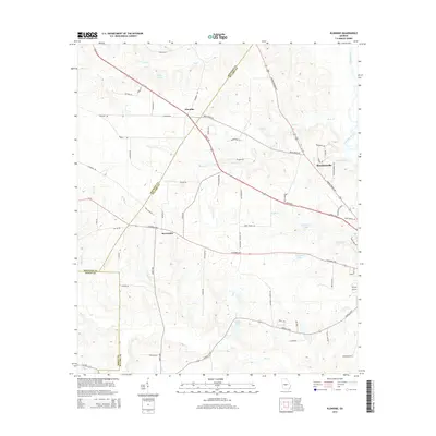
2014 Map of Klondike
USGS Topo · Published 2014About this map
Klondike sits at the intersection of several regional thoroughfares in Pulaski and Houston Counties, anchored by the long diagonal of Us-341 and the Perry Hwy. This central Georgia landscape is defined by its sophisticated network of named creeks and private lakes, with Buck Cr and Dry Cr winding through the terrain toward the eastern boundary. The map captures the rural residential and agricultural character of the region just west of the Ocmulgee River, showing how local infrastructure like Columbus Hwy and Ga-26 connects the small settlements of Browndale and the outskirts of Hawkinsville. Genealogists and local historians can trace family-named roads and landmarks such as Lee Paul Rd, Miller Pond, and Lawson Lake, which provide a detailed record of land use and property boundaries in this part of the Georgia coastal plain.
Find a feature on this map
72 named features on this map. Tap any name to fly to it.
Don’t see what you’re looking for? This feature index may not catch every label — zoom into the map to look around manually.
Map Details
Editions of this 2014 Klondike Map
This is the sole edition of this map. No revisions or reprints were ever made.
Other maps of this area

1956 · Cochran
USGS Topo · 1:62,500

1956 · Perry
USGS Topo · 1:62,500

1957 · Macon
USGS Topo · 1:250,000

1958 · Macon
USGS Topo · 1:250,000

1964 · Macon
USGS Topo · 1:250,000

1971 · Pineview NW
USGS Topo · 1:24,000

1972 · Finleyson East
USGS Topo · 1:24,000

1972 · Finleyson West
USGS Topo · 1:24,000

1973 · Hayneville
USGS Topo · 1:24,000

1973 · Klondike
USGS Topo · 1:24,000